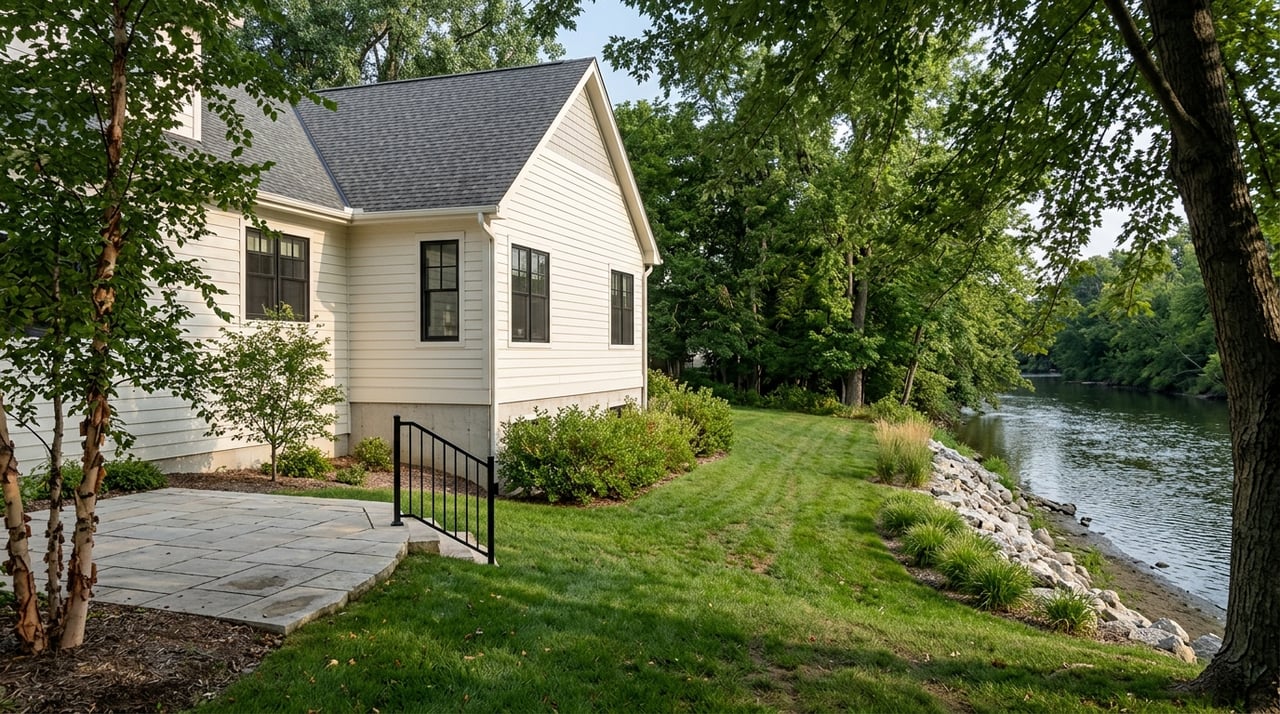
Dreaming about a place along the Root River or high on a bluff near Lanesboro? It is easy to fall for the views first. But in this part of Fillmore County, the same scenery that makes a property special can also shape what you can build, where you can place a septic system, and how you can legally access the land. This guide will help you understand the key issues to review before you buy, so you can move forward with more confidence. Let’s dive in.
Why Lanesboro properties need extra review
Lanesboro sits in the Root River valley, where the river winds past tall bluffs. That setting creates beautiful homesites and recreational appeal, but it also means many parcels are affected by overlapping land-use rules.
If you are looking at riverfront or bluff property near Lanesboro, you may need to review shoreland regulations, floodplain rules, bluff setbacks, septic requirements, and access limits all at once. A lot that looks simple on first showing can become much more complex once you study permits, maps, and setback lines.
For buyers, the goal is not to avoid these properties. It is to understand them clearly before you commit. With the right due diligence, you can spot issues early and make a more informed decision.
Shoreland rules can shape buildability
In Minnesota, shoreland law applies to land within 300 feet of a river or stream, or to the landward side of an ordinance-delineated floodplain, whichever is greater. In practical terms, that means many properties near the Root River may be subject to shoreland controls even if the usable building area feels farther from the water than you expected.
These rules can affect lot width, structure setbacks, septic setbacks, and the size of the shore impact zone. Fillmore County administers these standards through its local ordinance, and when more than one rule applies, the more restrictive standard controls.
For river parcels, the ordinary high water level setback can vary based on the river classification and whether the parcel is sewered. State rules show setbacks of 100 feet for unsewered parcels and 50 feet for sewered parcels on agricultural, urban, and tributary river segments, 150 feet for forested and transition river segments, and 200 feet for remote river segments.
That is why one of the first questions to ask is simple: What river classification applies to this parcel? That classification can directly affect where a home, addition, deck, garage, or septic area may be placed.
What buyers should ask about shoreland lots
Before you write an offer, ask for:
- The parcel’s shoreland classification
- Any county zoning or shoreland permit history
- A survey or plat showing setback lines and the ordinary high water level
- Records of any variance or conditional use approval
If a seller says a lot is buildable, that may be true, but you still want to confirm where it is buildable and under what limits.
Floodplain maps matter more than many buyers expect
A riverfront parcel can also fall within a regulated flood hazard area. Fillmore County regulates Floodway, Flood Fringe, and General Floodplain districts using FEMA Flood Insurance Rate Maps and an adopted Flood Insurance Study.
The county requires a permit before erecting or altering structures, placing fill, installing an on-site septic system, or altering a watercourse in the floodplain. That is a big reason floodplain status should be reviewed early, not after inspections are underway.
Flood mapping can also affect insurance and lending. FEMA’s Flood Map Service Center is the official public source for flood hazard maps, and lenders use flood maps when determining flood insurance requirements.
Why floodplain review matters
A lot may look dry and still have mapped floodplain constraints that affect:
- Home placement
- Future additions
- Septic location
- Driveway design
- Fill and grading work
- Insurance requirements
If the building site, septic field, or access road conflicts with floodplain controls, you may face extra permitting, redesign costs, or limits on future improvements.
Bluff property has its own set of rules
Blufftop property near Lanesboro can offer incredible views, but bluff regulations are often one of the biggest hidden issues for buyers. Fillmore County defines a bluff impact zone as the bluff plus land within 50 feet of the top and 30 feet of the toe.
Within that district, structures must be outside the bluff impact zone. Residential structures must also be set back 80 feet from the top of the bluff and 50 feet from the toe.
In addition, if residential construction is proposed within 200 feet of the top or 100 feet of the toe, Fillmore County requires a site development plan certified by a licensed civil engineer or surveyor. That requirement can affect both vacant land buyers and buyers considering future expansion of an existing home.
Bluff lots can bring added cost
Bluff review is not only about where you place the house. It can also affect grading, retaining walls, erosion control, and driveway placement.
The county limits earthwork in bluff areas and generally prohibits structural construction in the bluff impact zone except fencing. Filling and excavating in the bluff impact zone is also prohibited except for certain permitted quarry and sandpit activity.
If you are buying a bluff property, ask whether any grading, retaining wall, bank stabilization, riprap, or driveway work has already been permitted. Also ask whether a prior site plan was prepared by an engineer or surveyor. Those records can tell you a lot about what has already been reviewed and what future work may require.
Driveway access is not a small detail
On riverfront and bluff parcels, access can be just as important as the view. A property may have road frontage and still face limits on driveway location, slope, or future improvement.
Fillmore County says access drives onto county roads require review and approval by the county engineer or assistant engineer. That review looks at factors such as sight distance and road speed. The county zoning ordinance also requires access drives to be at least 12 feet wide.
Bluff-area access has even more constraints. Access drives must be 14 percent slope or less, cannot be located in a bluff impact zone if another alternative exists, and need erosion control measures on steeper drives.
If the parcel fronts a state highway, MnDOT requires a driveway or access permit before a direct driveway connection is constructed or modified. A permit is also required for a new driveway, a modified driveway, or a change in use that affects access.
Easements still need careful review
Private easements and recorded agreements can be just as important as county rules. Fillmore County’s floodplain ordinance states that it does not repeal or impair existing easements, covenants, or other private agreements.
That means you should not assume a shared lane, trail access, or informal agreement gives you permanent legal rights. For many rural properties, the real question is not just whether you can get in today. It is whether you can legally widen, resurface, improve, or relocate access later.
Septic review should happen early
Septic systems deserve close attention on any rural property, but they are especially important on riverfront and bluff parcels where slope, groundwater, bedrock, and floodplain conditions can all narrow your options.
Fillmore County requires a compliance inspection before real estate is sold or transferred when a subsurface sewage treatment system is involved. The county also requires a Fillmore County SSTS land transfer compliance form with every property transfer.
The inspection report or certificate must show whether the system is compliant, failing, or an imminent public health threat. In general, a certificate of compliance for an existing system is valid for three years, while a new-system certificate is valid for five years.
Septic placement can limit a river lot
When reviewing septic suitability, the county considers groundwater, bedrock, soil conditions, slope, low lands, surface depressions, and rock outcrops. If public information is not enough to judge the site, the applicant must provide soil borings and percolation tests.
That matters because the most obvious open area on a lot is not always a usable septic area. Fillmore County also says on-site sewage treatment systems should not be located in a floodway and should be avoided in floodplains when possible.
On some river parcels, the floodplain and the likely septic field area overlap. When that happens, a lot that looks large enough on paper may have a much smaller functional building envelope than you expected.
Documents to request before you buy
A strong document review can save you time, money, and stress. Before or during the early stages of a purchase, try to gather the records that speak directly to buildability, compliance, and access.
Here are the most useful items to request:
- Current FEMA flood map or FIRMette for the parcel
- Any Letter of Map Change or elevation certificate, if available
- County zoning, shoreland, floodplain, grading, or bluff permit history
- Any variance or conditional use permit records
- Septic permit, design, compliance inspection, pumping records, and corrective-action records
- Fillmore County SSTS land transfer compliance form
- Survey or plat showing the ordinary high water level, bluff top, bluff toe, setbacks, easements, and access corridor
- Access permit or county road approval, if applicable
If a seller cannot provide current septic compliance documents, it is wise to plan for a new inspection early in the transaction.
Smart questions to ask during a showing
When you tour riverfront or bluff property near Lanesboro, it helps to ask direct questions that move beyond the view. A few practical questions can quickly reveal whether a property has already cleared the biggest hurdles.
Ask questions like:
- What DNR shoreland classification applies to this river segment?
- Does Fillmore County apply any stricter local rule here?
- Is any part of the lot in the floodway, flood fringe, or general floodplain?
- Have the bluff top, bluff toe, or access drive been surveyed or engineered?
- Is the septic system current and compliant?
- Is the septic area outside flood-prone parts of the lot?
- Is access legal, recorded, and usable year-round?
- Can the driveway be improved later if needed?
These questions can help you separate a great opportunity from a property that may need more time, money, or specialist review than you planned.
Why local guidance matters in Fillmore County
Properties near Lanesboro often require a more detailed review than a standard in-town home. You may be dealing with county zoning, state shoreland standards, floodplain mapping, septic transfer rules, slope limits, and recorded easements all on the same purchase.
That is where local buyer guidance can make a real difference. When you work with someone who understands southeast Minnesota land issues, you are more likely to ask the right questions early, gather the right documents, and avoid surprises late in the deal.
John Nelson’s approach is built around practical help, clear communication, and local knowledge of county-level issues like septic, shoreland, and easements. If you are considering riverfront or bluff property near Lanesboro, having a responsive local advocate can help you evaluate the property with a clearer picture of both the opportunity and the risks.
If you are thinking about buying near Lanesboro and want a second set of eyes on a riverfront or bluff property, reach out to John Nelson for practical local guidance and full-service buyer support.
FAQs
What should you check before buying riverfront property near Lanesboro, MN?
- Review the parcel’s shoreland classification, floodplain status, setback limits, septic records, permit history, survey details, and legal access before you buy.
What are shoreland setbacks for river property in Fillmore County?
- Setbacks depend on the river classification and whether the parcel is sewered, with state rules showing 50 feet, 100 feet, 150 feet, or 200 feet depending on the parcel and river segment.
What is a bluff impact zone in Fillmore County, MN?
- Fillmore County defines the bluff impact zone as the bluff plus land within 50 feet of the top and 30 feet of the toe, and structures must be outside that zone.
Why is septic review important for bluff or river lots near Lanesboro?
- Septic review matters because slope, bedrock, groundwater, soil conditions, and floodplain overlap can limit where a compliant system can be located.
Do you need permits for driveway access on rural property near Lanesboro?
- Yes, county road approaches require county review and approval, and state highway access requires an MnDOT permit for new or modified driveway connections.
Can a riverfront lot near Lanesboro be in a floodplain even if it looks buildable?
- Yes, a parcel can appear usable on site but still include mapped Floodway, Flood Fringe, or General Floodplain areas that affect structures, septic placement, fill, and insurance requirements.